

meta data for this page
Sierra de Tecka/Tepuel
If you use any of the work presented on these pages, please cite the work as:
Heine, Christian (2001), Geological Map of the southern Sierra de Tecka (north of Laguna Quichaura), Province of Chubut, Argentina. Diplom-Kartierung (M.Sc. mapping fieldwork), Institut für Geologie, Mineralogie und Geophysik, Ruhr-Universität Bochum, Germany. URL: https:paleoearthlabs.org/pdf/Heine_2001_SierraDeTeckaMapping_MSc.pdf
- Heine.2001.bib
@techreport{Heine.2001,
	author = {Heine, Christian},
	eprint = {https:paleoearthlabs.org/pdf/Heine_2001_SierraDeTeckaMapping_MSc.pdf},
	institution = {{Institute for Geology, Mineralogy and Geophysics; Ruhr-Universit\"at Bochum, Germany} },
	location = {Bochum, Germany},
	pagetotal = {50},
	title = {{Geological map of the southern Sierra de Tecka (north of the Laguna Quichaura), Province of Chubut Argentina}},
	type = {{Diplomkartierung/M.Sc. Fieldwork}},
	year = {2001}}
Sub pages
Photogallery


Sierra de Tecka Fieldwork 1999-2000
Pictures from fieldwork/mapping in the Sierra de Tecka/Prov. Chubut, Argentina
23 images
©1999-2020 Christian Heine
Related pages
Summary
During the southern summer of 1999/2000 I did some field mapping (“Diplomkartierung”) required for my Geology M.Sc (“Diplom”). The project was a collaboration between the Universidad Nacional de la Patagonia in Comodoro Rivadavia (Argentina), supervised locally by Marcelo Marquez and the Institute for Geology, Mineralogy & Geophysics at the Ruhr-University in Bochum (DE), supervised by Bernhard Stöckhert.
operating instructions
Various functions are available as part of the map.
mouse/touch operation
- moving by grabbing the map with a mouse-click you can move the map around
- overview map using the < button in the bottom right of the map you can expand an overview map
- zooming in and out using the + and - buttons in the top left of the map you can obtain more or less detail in the map
- switching themes or maps clicking on the ≡ icon on the right-hand side of the map you can view and select available maps and themes
- retrieving information the map may contain elements that contain more information, by clicking these a popup will show this information
- fullscreen display using the ⛶ button the map can be maximized to fullscreen display, use the ▢ button to return to page display.
keyboard operation
Keyboard operation becomes available after activating the map using the tab key (the map will show a focus indicator ring).
- moving using the arrow keys you can move the map
- overview map using the + button in the bottom right of the map you can expand an overview map
- zooming in and out using the + and - buttons in the top left of the map or by using the + and - keys you can obtain more or less detail in the map
- switching themes or maps clicking on the ≡ icon on the right-hand side of the map you can view and select available maps and themes
- retrieving information the map may contain elements that contain more information, using the i key you can activate a cursor that may be moved using the arrow keys, pressing the enter will execute an information retrieval. press the i or the escape key to return to navigation mode
- fullscreen display using the ⛶ button the map can be maximized to fullscreen display, use the ▢ button to return to page display.
It's possible that some of the functions or buttons describe above have been disabled by the page author or the administrator

| id | symbol | latitude | longitude | description |
|---|---|---|---|---|
| Basemap with sample and outcrop locations | ||||
| 1 | -43.525278º | -70.684167º | Base Camp at Señor Rios |
|
| 2 | -43.5218º | -70.6772º | Camp |
|
| 3 | -43.5175º | -70.6772º | Hausberg Top |
|
| 4 | -43.5052º | -70.6805º | Pass |
|
| 5 | -43.5015º | -70.663º | Co. Redondo Top |
|
| 6 | -43.4895º | -70.68º | 2nd E-W Fence near Burned Sheep Hill |
|
| 7 | -43.4907º | -70.6483º | Abandoned Pto NE. El Solitario |
|
| 8 | -43.5112º | -70.6817º | Border Lutz |
|
| 9 | -43.5113º | -70.6828º | Border Lutz |
|
| 10 | -43.487º | -70.6678º | Loc. 123 |
|
| 11 | -43.5255º | -70.6823º | N-S-Fence to Ea. LaBlanche |
|
| 12 | -43.507º | -70.6425º | Pto. El Solitario |
|
| 13 | -43.5245º | -70.6773º | Gate driveway Pto. Rios |
|
| 14 | -43.4897º | -70.8135º | Tecka boarding school |
|
| 15 | -43.5557º | -70.6587º | Tor Siltam |
|
| 16 | -43.5218º | -70.6772º | WPT 001 |
|
| 17 | -43.5527º | -70.6853º | WPT 002 |
|
Abbreviations used in this Report
| Abbreviation | Spanish | English |
|---|---|---|
| asl. | above sea level | |
| Co. | Cerro | Peak |
| RN | Ruta Nacional | National road |
| RP | Ruta Provincial | Provincial road |
| Ea. | Estancia | Farm |
| Establ. | Establicimiento | smaller Farm, belonging to an Estancia |
| Pto. | Puesto | Hut, outpost of an Estancia |
| Fm. | Formacíon | Formation |
| Lag. | Laguna | salty lake |
| Loc. | Locality, outcrop |
Chapter 1 - Introduction
Introduction
This work is a Diploma-Mapping carried out at the Institute for Geology, Mineralogy and Geophysics, Ruhr-Universität Bochum, Germany in cooperation with the Universidad Nacional de la Patagonia San Juan Bosco in Comodoro Rivadavia, Argentina. Prof. Dr. B. Stöckhert directed the project in Bochum, while fieldwork in Argentina has been guided and attended by Prof. Marcelo J. Márquez (Comodoro Rivadavia).
The mapping area is located in the southern Sierra de Tecka, north of the Laguna Quichaura, Chubut Province, Argentina. Fieldwork lasted from Mid-December 1999 to End of January 2000. The working area was subdivided into areas No.1 (Claudius Vandré), No. 2 (Christian Heine) and No.3 (Lutz Limburg), each with an approximate size of 20-23km² (see Figs. 2b and 3).
1.1 Map base and Techniques
Geological data collected in the field were copied to a transparent paper superimposed onto the aerial view. Back in Germany negatives of the aerial view and the Landsat image have been scanned and modified using Adobe Photoshop(R) software. The geological field data were copied onto the modified images using Macromedia Freehand® and Corel Draw® graphic software to produce the final geological map. Additionally to the fieldwork, photolineament analyses and interpretation have been carried out on the LANDSAT image and aerial views.
A Magellan®-GPS Receiver, a Freiberger compass, fitted to the magnetic field of the southern hemisphere, and an air-pressure-based Casio® Altimeter have been used for orientation, localisation of the outcrops and measuring the orientation of geological structures.
The altimeter has been calibrated at topographic points in Tecka; multiple elevation measurements resulted in a base camp altitude of 945m asl. Because of the daily air pressure variations the given elevations should be taken as the best possible approximation. GPS signal disturbance with inaccuracies of ±200m, aerial view distortion and the quality of the aerial view prevented exact outcrop and latitude/longitude grid localisation.
Macroscopic rock description was carried out in the field with the help of a hand lens. A limited amount of samples taken were shipped to Germany and their mineral content as well as their microstructures were analysed using polarisation microscopy.
 Fig. 1: The base camp next to the Pto. Rios (left). View to NW.
figure 1 shows the base camp, which was located at the triple point of the three mapping areas next to the Pto. Rios approximately 300m north of the RP 62. Working conditions have been hard due to restricted fresh water and food reserves, living in tents and stormy winds. We tried to establish a rhythm of five days fieldwork and two days in the Tecka boarding school to do theoretical work and to supply ourselves with fresh water and food.
Chapter 2 - Geographical Overview
2.1 Patagonia - A Brief Geographical Outline
The South American continent can be geographically subdivided in several regions. The southernmost is Patagonia reaching from the Río Colorado at 38°S Latitude over a length of 3200km down to the Strait of Magellan. The eastern part (E of the Andes) belongs politically to Argentina (Provinces of Río Negro, Chubut and Santa Cruz), the part west of the Andes to Chile.
The Patagonian Cordillera as the southern part of the Andean Mountain range and the Patagonian tableland are the main morphological features of this region. The north-south striking Andes rise from the Chilean Pacific coast within a distance of 100km to heights around 3500m asl. (Lanín Volcano at 40°S: 3773m; Co. Fitz Roy at 49°S: 3400m). Between the alpine region of the Cordillera and the tableland, the Patagonide Ranges (or Pre-Cordillera) are situated [Turner, 1982; Uliana & Biddle, 1987]. From here the Patagonian tableland descends from heights around 1000m in several steps towards the Atlantic coast.
 Fig. 2: Fig. 2: (a) Position of Chubut Province with major cities, roads and rivers. The white rectangle represents position of the second map. Produced with free GMT software at www.aquarius.geomar.de/omc
 Fig. 3: Fig. 2: (b) Generalised sketch of the Sierras de Tecka, Tepuel and Languiñeo.
The Patagonian climate represents one of the world’s sharpest climatic contrasts. Areas west of the main Andean range (Chilean coast and within the Cordillera) gain up to 5000mm/yr precipitation, in contrast to a very dry semiarid belt with only 200-300mm/yr. precipitation in the east. The Patagonian Ice Shield covers the highest regions of the Cordillera between 46° and 51°S. It gains snowfalls throughout the year. Vegetation changes within a distance of tens of kilometres from cold-temperate rainforests at the Chilean coast to steppe and desert vegetation (drought tolerant scrubs and grasses) in eastern Patagonia.
The hard living conditions in the Argentine part of Patagonia are reflected by the population density of about 1/km2 Britannica.com Encyclopedia (2000). Most of the people in the Argentine Patagonian provinces live close to the Atlantic coast in cities like Comodoro Rivadavia, Río Gallegos and Rawson, which provide infrastructure e.g. hospitals, high schools, universities, authorities and airports. The RN 3 connects Patagonian coastal regions, and the main cities, with Buenos Aires. Near the Andean range the RN 40 serves remote areas. The main economies of this region are oil/gas and mineral exploitation as well as animal husbandry (mainly sheep breeding). Oil and gas fields are found in the huge cretaceous-tertiary basins on- and offshore the Atlantic coast (e.g. Neuquén-, Magellanes- and San Jorge Basin). Valuable mineral deposits including iron, vanadium, manganese, copper, silver and gold are found in the hinterland [www.britannica.com].
2.2 The Mapping area: Location, Geomorphology, Vegetation and Climate
The working area is located in the southern Sierra de Tecka in the central western Province of Chubut, approximately 80km east of the main Andean mountain range and 15km east of the little village of Tecka in the District of Languiñeo (see Figs. 2a & 2b). It belongs geomorphologically to the Patagonide Ranges or Pre-Cordillera [Turner, 1982]. Extending nearly 60km in N-S direction, the Sierra de Tecka reaches from the Río Gualjaina near Arroyo Pescado and the RN 25 down to the RP 62. In E-W direction, the maximum width is 20km, limited to the east by the depression of Arroyo Languiñeo, and to the west by the Río Tecka valley. It has a clearly asymmetric shape, with a smooth eastern and an abrupt western slope [Márquez & Giacosa, 1999]. Reaching maximum heights of up to 1552m (Co. Negro de Tecka), various peaks are between 1200m and 1500m asl. In its northern and central sections the relief is smooth, while the southern parts show a more rugged and accentuated relief [Turner, 1982]. The south-western parts link to the Sierra de Tepuel, a similar ridge that extends over a distance of approximately 70 to 80km down to the village of Gobernador Costa. The altitudes reached here are a few 100 meters higher (up to 1700m, Co. Putrachoique) than in the Sierra de Tecka.
The Sierras de Tecka and Tepuel belong to the “antecordillerana” climate zone [Turner, 1982] that is transitional between the semiarid climate of the Patagonian tableland in the east and the humid cordillera, with frequent rainfalls in the west [Turner, 1982]. Annual average temperatures are 8-9°C and the average precipitation ranges between 200-300mm/yr., with most of the rain / snowfalls during the winter months from April to October [Turner, 1982]. This low amount of precipitation prevents the development of pedal horizons, which are restricted to valleys (alluvial soils) and depressions (salty soils). Xerophytic (drought-tolerant) and halophytic (salt-tolerant) grasses and shrubs predominate the vegetation which is low and needs almost no water [www.britannica.com]. Trees are virtually absent and mostly planted by landowners for wind protection of Estancias (farms) and Puestos (outposts of estancias). The drainage pattern is controlled by the dry climate. Canyons and valleys run water only during the snowmelt and heavy rainfalls in the winter or spring. In summer times they are mostly dry. The western slopes of the Sierra de Tecka drain into the Tecka River, the southern parts in the Laguna Quichaura, the eastern parts into the intramontane Laguna Aleusca (salty). Originating in the Patagonian Cordillera, the Tecka River flows into the Río Chubut, which reaches the Atlantic Ocean at the city of Rawson.
Civilisation is concentrated in the little village of Tecka, with approximately 600 inhabitants of mainly aboriginal origin (tribe of the Mapuche - Indians). Tecka is situated 15km west of the mapping area in the Río Tecka valley. It is the only settlement in an area of 60km in diameter and has got a small hospital, police station, post office, petrol station, two general stores and a boarding school for the children of this region as well as electricity and telephone. Numerous Estancias and Puestos are distributed in the Sierras de Tecka and Tepuel. Following the Río Tecka, the RN 40 touches Tecka and connects it with Esquel in the north (90km, 25000 inhabitants) and José de San Martín (100km) in the south. Branching off at Tecka, the RP 62 links the RN40 with Trelew (≈350km) and the province capital Rawson at the Atlantic coast in the east. The general income level of the rural inhabitants is very low.
The mapping area comprises nearly 23 km2 and is located north of the salty Laguna Quichaura, in the transitional area between the Sierras de Tecka and Tepuel. The geographic coordinates limiting the area are approximately 43°28’40’’S to 43°32’S Latitude and 70°37’40’’W to 70°41’W Longitude. The east and northern extend of the area have been given by the frame of the magnified aerial view OL 406-6760 [Instituto Geográfico Militar]. The southern boundary to the area no.1 (Claudius Vandré) is given by the RP62, the western boundary to the area no. 3 (Lutz Limburg) by a north-south trending fence approximately parallel to 70°41’W (Fig. 3).
 The topographic map of Fig.3 shows a marked relief, characterising main parts of the area. Elevations of 940m at the Laguna Quichaura and up to more than 1300m at the Top of the Co. Redondo (1317m, centre of the mapping area) and the Guanaco Hills at the northern boundary are reached. While the southeastern part (Laguna Quichaura region) of the area has a gentle or smooth morphology, the rest of the mapping area is hilly to steep. In this part the Co. Redondo, the northerly adjacent valley and hills as well as the Guanaco Hills are encountered. Land owned by the Estancia Asef covers most of the working area and is used for sheep breeding. The Pto. Rios and the Establ. Siltam, 3km south of the RP62 are the only occupied houses. The Pto. El Solitario and the Pto. 2 in the eastern parts of the mapping area are deserted.
Chapter 3 - Geological overview
The geology of the South American continent is characterised by two contrasting main structural elements: the Andean Cordillera at the western margin of the continent and the cratonic region of eastern South America.
 The Andean mountain range as a part of the circum-pacific orogenic belt is one of the worlds tectonically most active zones with intense volcanic and seismic activity. Genetically it is the result of at least 300 million years of subduction. In contrast, the eastern part of South America is a tectonically passive cratonic region build up of Precambrian consolidated shields [Zeil, 1986; Ramos, 1988]. In-between these two elements Meso- to Cenozoic sedimentary basins such as the Patagonian San Jorge and the Magellanes Basin or the Llanos of Venezuela, are located [Zeil, 1986].
Southern South America’s geological history has been interpreted in recent years in the light of modern plate tectonics. However, the exact spatial and temporal limits of the tectonic framework and processes, which formed especially the Patagonian part of the continent, are still controversially discussed and not well defined.
3.1 Geological history
The geological evolution of Patagonia has been strongly influenced by events which occurred while it was a part of the South American sector of Gondwanaland, as well as by the plate boundary geometry and velocities at the convergent margin at the western part of the continent [Uliana & Biddle, 1987]. There is evidence of semi-continuous subduction of Pacific ocean-floor throughout the Phanerozoic [Forsythe, 1982]. According to Uliana & Biddle (1987) a division into three main phases for the time from Late Paleozoic to Cenozoic is very useful to give a clearly structured outline of the geological record of Patagonia. These are:
- a pre break-up phase (Carboniferous to Early Triassic),
- the break-up phase (Late Triassic – Early Cretaceous), and
- a post break-up phase (Early Cretaceous to Recent),

which are described in the following with a special focus on the working area in the Sierra de Tecka.
The basement of southern South America is build up of a complex collage of major cratonic blocks that have been brought together along the southwestern margin of Gondwanaland during the Brasiliano orogenic cycle (Late Proterozoic to Early Mesozoic) (see Fig. 5). Outcrops of Precambrian rocks are found in the Patagonian Deseado and Somuncurá massifs. Accretion of allochthonous terranes started in the late Precambrian and was completed by mid-Paleozoic times [Ramos, 1988]. However, according to Cingolani et al. (1991), there is no equivocal evidence for a separate Patagonia-Terrane, as postulated by Ramos (1988).
3.1.1 Pre break-up Evolution (Carboniferous to early Triassic)
 Since Devonian times, subduction at the western margin of the Gondwanian supercontinent led to broad Andean-type convergent margin and associated compressional deformation that is referred to as the Gonwanidian orogenic cycle [Pankhurst & Rapela, 1995]. Forsythe (1982) has identified three roughly linear NNW trending tectonostratigraphic belts crosscutting obliquely through Patagonia (Fig. 6). These are from west to east: a forearc consisting in parts of oceanic components, a magmatic arc coincident with Carboniferous to Triassic continental non-marine sedimentation, and a back-arc region comprising the epicratonic sequences of the Samfrau Geosyncline. Paleozoic sedimentary rocks are described from both the Patagonide Ranges that represent the forearc region, and the backarc in the Ventania/Colorado basin area.
The Upper Carboniferous Tepuel Group outcropping in the Patagonide Ranges is a thick siliciclastic succession deposited in narrow NNW trending basins with a littoral to shelfal setting. It is composed mainly of sandstones, diamictites and turbidites and occupies a medial position with respect to forearc and magmatic arc series [Forsythe, 1982; Uliana & Biddle, 1987]. Rocks of this unit have been referred to as the “Cuenca Central Patagónica” [Suero, 1962] and are interpreted to have a forearc to intra-arc setting. Their abrupt eastern margin is close to the coeval magmatic province of Patagonia [Forsythe, 1982]. Evidence for shortening is found in these sediments. [Márquez & Giacosa, 1999]. Rocks of this group occur in the working area. Subduction at the western margin of Gondwana with a shallow easterly dipping slab fits the model of a broad magmatic arc and backarc deformation in the Ventania area [Forsythe, 1982; Ramos, 1983].
3.1.2 Break-up Phase (Late Triassic – Early Cretaceous)
 With the beginning of the Latest Triassic, major changes in the tectonic regime of southern Gondwanaland took place that finally heralded in the break-up between South America, Africa and Antarctica. The pre break-up compression in the Patagonian part of Gondwanaland switched to widespread extension that was accompanied by extensive volcanism, leading to one of the world’s largest rhyolitic provinces (Chon Aike and Tobifera volcanics). Geochemical analyses indicates that significant crustal anatexis under conditions of regional extension was involved [Gust et al., 1985; Uliana & Biddle, 1987; Storey et al., 1992; Rapela & Pankhurst, 1992]. Whereas the timing and plate tectonic framework of the southern Gondwana break-up are constrained by seafloor data (Fig. 7) [Nürnberg & Müller, 1991; Lawver et al., 1999], the mechanisms are still poorly understood. Different models have been proposed to explain especially the processes that happened in the Patagonian region during this phase.
According to Gust et al. (1985) and Storey at al. (1992), changes in the angle from shallow to steeper slab subduction may have resulted in a change from a compressional to an extensional regime with thinning of continental crust, graben formation and associated volcanism. However, Rapela & Pankhurst (1992) consider a dextral movement of the South Patagonian Block (SPB) along the Gastre Fault System (GFS) relative to the rest of southern South America, and the overriding of a subduction zone as the causes of extension and partial crustal melting in Patagonia. This model is also part of the plate tectonic reconstruction by Lawver et al. (1999) (Fig. 7).
An alternative model is presented by Martinez (2000) who considers the cratonic region of southern South America as reaching down to the Islas Malvinas. Here, dextral movements of parts of southern South America are not required.
Crustal extension, associated with one of the most significant regional unconformities in Patagonia, continued throughout the Jurassic and lead to the formation of narrow grabens or half-grabens, following the pre break-up basement grain (roughly NNW). Igneous activity cumulated in the Mid- to Late Jurassic (165-155 Ma) and volcanic rocks generated by partial melting of mafic lower crust are widespread throughout Patagonia [Pankhurst & Rapela, 1995; Uliana & Biddle, 1987]. West of the Somuncurá massif, in the Patagonide Ranges and in the north Patagonian Andes, andesites and basalts are dominant. Also, subduction related magmatic activity occurred in the Argentine-Chilean border region [Gust et al., 1985; Ramos, 1983].
Sedimentary deposits west of the Somuncurá massif of Lower to Middle Jurassic age (e.g. the Lepá Formation of the Patagonide Ranges) show a broad variety of continental and local marine facies and are associated with volcanic and volcaniclastic rocks [Riccardi et al., 1992]. The dominance of volcanic and volcaniclastic rocks increases towards the late Jurassic. Abrupt and intricate facies changes as well as the distribution of coarse-grained fragments of basement rock shows that this sequence was deposited in fault-bounded troughs [Uliana & Biddle, 1987]. A number of gabbroic bodies (e.g. the Gabbro Cresta de los Bosques) of olivine-tholeiitic and noritic composition intruded marine Liassic sediments in the Patagonide Ranges at about 43˚S by Early Cretaceous times controlled by deep fractures and/or crustal thinning [Page, 1984]. They were interpreted to have marginal basin affinities and to be the expression of the opening and creation of oceanic crust in the of the Rocas Verdes basin at the western margin of southernmost South America [(Bruhn.EPSL.1978)]; [Saunders et al., 1979; Dalziel, 1981].
The extension and volcanism that started in the late Triassic and continued through Jurassic times is seen as the precursor of events that finally led to the formation of oceanic crust in the South Atlantic in the Early Cretaceous [Uliana & Biddle, 1987].
3.1.3 Post Break-up Evolution (early Cretaceous – Recent)
The onset of seafloor spreading in the Southern Atlantic initiated a major change in southern South American tectonics that is known as the Andean cycle [Pankhurst & Rapela, 1995]. Since the Early Cretaceous, processes taking place at the western margin of the continent control the further geological evolution of Patagonia.
Subduction of Pacific Plate oceanfloor lead to voluminous intrusions and volcanism in the western third of the continent. Between 100 – 85 million years most of the Patagonian Batholith was emplaced which correlates with an episode of global high seafloor spreading rates [Haller & Lapido, 1982].
Block-faulting, regional uplift and partial inversion of older normal faults during the Andean compressional phase dominate the tectonic style of the post break-up phase in the Patagonian Andes. South of 43˚S, a gap in the Eocene magmatic arc and formation of plateau basalts may be related to a proposed collision of the Aluk - Farralon ridge with the trench [Ramos & Kay, 1992]. Late Miocene to recent plateau basalt eruptions of southern Patagonia are probably associated with subduction of segments of the Chile ridge [Ramos & Kay, 1992]. An eruptive complex of volcanic and proximal pyroclastic deposits with basaltic, andesitic and rhyolitic composition occurs in the western third of the continent and along the eastern flank of the Andes in northern Chubut in the late Cretaceous to early Tertiary [Uliana & Biddle, 1987]. In the Patagonide Ranges this sequence is known as the Complejo La Cautiva and Ventana Formation [Turner, 1982; Márquez, pers. comm.].
Early Cretaceous to recent sedimentary rocks are widespread in. A marginal basement ridge at the edge of the Patagonian segment of South America subsided during the Late Cretaceous and allowed intense transgression from the east to occur. Late Cretaceous and younger strata are mainly subhorizontal and deformed only by small displacement normal along faults [Uliana & Biddle, 1987].
Decay of the break-up thermal event initiated the post-rifting subsidence of Magellanes, San Jorge, Malvinas and Neuquén Basins. In addition, it likely controlled the depositional trends throughout Patagonia in the post break-up phase.
3.2 Stratigraphic Units in the Sierra de Tecka and Sierra Tepuel

A generalised stratigraphic column is given in Fig. 8. The oldest rocks exposed in the Sierras de Tecka and Tepuel are the Late Paleozoic sediments of the Tepuel Group, which have been deposited in the Palaeozoic to early Mesozoic central Patagonian basin or “Cuenca Central Patagónica” [Forsythe, 1982; Gust et al., 1985; Suero, 1962]. They rest unconformably on granitic or metamorphic basement rocks and consist of a thick siliciclastic sequence composed of shales, sandstones and conglomerates of probably glacial origin. The source region may have been the pre-break-up magmatic arc described by Forsythe (1982). Fossils suggest Carboniferous to Lower Permian ages. A recent work by Márquez & Giacosa (1999) describes ductile deformation within the Tepuel Group. Therefore facies and sequence stratigraphic analyses as well as paleomagnetic results of previous workers (e.g. Page, 1984, Rapalini et al., 1994) may be invalid, and are to be re-examined by further investigations.
Liassic sedimentary rocks of the Osta Arena (or Lepá) Formation overlie unconformably the Late Paleozoic sediments of the Tepuel Group. Ammonites and Bivalves indicate Pliensbachian to early Toarcian age of this formation [Riccardi et al. 1992]. Sedimentological analyses suggest a shallow marine to littoral environment for the lower part, comprising a basal conglomerate, sandstones, siltstones, and intercalated shales and tuffs. The upper part is built up of mainly continental sediments and pyroclastic rocks. A fluviatile system with braided rivers and flood plains is considered to be the depositional environment [Franchi et al. 1989]. Thickness decreases from a maximum of 500m in the Sierra de Tecka to 80m in the eastern Patagonide Ranges [Franchi et al. 1989]. The Osta Arena Formation is probably overlain by Mid- to late Jurassic andesites and volcaniclastic rocks with intercalated siliciclastic deposits [Riccardi et al., 1992].
Late Jurassic to early Cretaceous gabbroic rocks of the Cresta de los Bosques (or Tecka) Formation intruded both the Paleozoic and Liassic sediments. Petrographical and chemical analyses, carried out by Page (1984) in the southern Sierra Tepuel, have shown numerous intrusive bodies ranging from olivine-tholeiitic to noritic composition.
Late Cretaceous to Eocene volcanic rocks of basaltic to andesitic composition (La Cautiva Complex and Ventana or Carinao Formation) and associated sedimentary rocks were deposited unconformably over the Liassic sequence in the Sierra de Tecka. The diatomites of the Carinao Formation and the siliciclastic sediments of the La Mimosa Formation have been deposited preferably in intramontane basins during Oligocene-Miocene times.
Quaternary glacial gravels and fluvial terraces are found in the Río Tecka valley. The bedrock is covered by alluvial regolith.
Chapter 4 - Lithological units in the mapping area
The rocks exposed in the area have been assigned to four main mapping units and the alluvial cover. The Tepuel Group is the oldest unit with Late Paleozoic sedimentation ages, overlain unconformably by unmetamorphic Liassic marine to continental sediments and pyroclastic rocks of the Lepá Formation. Early Cretaceous gabbroic rocks of the Tecka Formation have intruded along the unconformity and the older units. Tertiary dykes as well as pyro- and epiclastic deposits overly unconformably the gabbro. Alluvial regolith and soils cover the lower slopes of hills and valley floors.
4.1 Tepuel Group

This mapping unit shows significant differences in comparison to the overlying Liassic rocks. Main characteristics are the consolidated or very low-grade metamorphic, compositionally mature quartz-dominated sediments, the occurrence of folds, outcrop morphologies and poor preservation of sedimentary structures. Therefore, these rocks are assigned to the Upper Carboniferous to Lower Permian Tepuel Group, which has been proven by Márquez (pers. comm.). Neither a lithological subdivision nor an assignment to subunits that were established by Page et al. (1984) has been possible.
4.1.1 Field observations
Outcrops of the Tepuel Group sediments are restricted to the southwestern part of the mapping area near the Pto. Rios (Loc. 17-19, 27-30, 112, 114 and 155-157). The exposure conditions were bad because of weathering, moss, grass and scrub vegetation. Silt- and fine-grained sandstones of this unit show smooth internal structures that are interpreted as small-scale folds. Often sedimentary structures and bedding could not be identified equivocally. At Loc. 29 and L175 (Area 3, Lutz Limburg) folded strata of this unit are exposed. Loc. 29 shows an isoclinal NW-vergent fold in a succession of conglomerates, sandstones and siltstones (Figs. 33 & 34). A detailed description is given in Chapter 5 –Tectonics and Structures. The delimitation to the overlying Liassic rocks is characterised by an angular unconformity best exposed in the hill N of the base camp (see Fig. 9).
 The most characteristic lithology of the Tepuel Group sediments are light-grey and mature arenites, composed mainly of well-rounded quartz grains (e.g. CH 41 & CH 167). The grain sizes vary between 0.5 and 1mm. Other minerals identifiable with a hand lens are mica and ore minerals. The general character of these sediments is very massive. Polymictic, dark-coloured conglomerates with well-rounded components occur as thin layers (5 to 10 cm thick) (e.g. Loc. 74) in the quartzitic arenites described above, representing graded bedding. The grain size ranges from 0.3cm to 3cm, the amount of matrix is significantly higher than 15%. According to Füchtbauer (1988), this sediment is characterised as a diamictite or paraconglomerate. Quartz is the dominating mineral. Fig. 10 shows a boulder found around Loc. 28, representing a conglomerate with internal decreasing grain-size from pebble- to coarse-grained sand. Subordinate, massive yellowish fine-grained sandstone and siltstone layers with variable thickness also occur in this sequence.
4.1.2 Microscopic description
 Three thin sections have been prepared of this unit. All sections show siliciclastic sediments composed mainly of quartz grains. Samples CH167 (Loc. 28, Fig. 10) and CH41 (Loc. 74, Fig. 11) have at least 90-95% of well-rounded and well-sorted quartz grains with a very low amount of matrix and detrital Feldspar grains. The average grain sizes range between 350-450μm (CH41) and 400-550μm (CH167), respectively. Epitactic grown quartz cement has filled the pore space. Iron oxide and clay coatings mark the outline of the original grains that were overgrown by the cement. Some quartz grains show undulose extinction as well as dynamic recrystallisation, which may reflect their metamorphic origin. Inclusions of rutile and biotite suggest probably a magmatic source region for approximately 20% of the quartz grains. Pressure solution phenomena and strain induced boundary migration are the microstructures indicating temperatures of about 300˚ to 350˚C [Passchier & Trouw, 1996]. The samples show no evidence for significant ductile deformation. According to the classification of Tucker (1981) the rock can be named as a quartz arenite. The fine-grained rocks (e.g. CH157) are composed mainly of angular quartz grains with average grain sizes ranging between 20 and 40μm. Opaque minerals as well as mica are subordinate components. Microfractures are coated with a thin layer of iron oxides and filled with polygonal quartz, representing a grain boundary energy controlled fabric. This lithology can be described as a medium to coarse-grained quartzitic siltstone. The massive nature and missing of internal structures may be the result of sedimentary mass movements [Tucker, 1981] or deformational processes.

4.2 Osta Arena / Lepá Formation
 This mapping unit has been assigned to the Osta Arena (or Lepá) formation because of its fossils and lithologies. Liassic rocks cover approximately 40% of the mapping area and are found mainly in the central and northern sections of the area. They unconformably overly rocks of the Tepuel Group. Evidences for a basal conglomerate are found in the southern part of the mapping area where conglomeratic sandstone boulders predominate in the regolith. This unit can be subdivided in a lower part, composed of predominantly shallow marine sediments and an upper part that is composed of fluviatile to continental sediments of mainly volcanic source. A clear morphological expression for the lithological change within the unit is found around the Co. Redondo (compare Fig. 13). The complete sequence is exposed on the southeastern flank of the Co. Redondo (right side of the picture). The classification of the sandstones follows Pettijohn (1975) and Pettijohn et al (1972), while pyro- and epiclastic rocks have been classified according to Fisher & Schmincke (1984) and Schmincke in Füchtbauer (1988). Due to the intrusion of gabbroic rocks, contact metamorphism affected the overlying Liassic rocks and resulted in Hornfels. This phenomenon is discussed in the chapter “Contact metamorphism”. The estimated thickness of this unit is at least 300m.
4.2.1 Marine Sequence
4.2.1.1 Field observations
Outcrops are found around the Co. Redondo in the central mapping area as well as near the RP62 in the south, at the hill N of the Co. Redondo and in the northern parts. A complex and meshed facies mosaic of conglomerates, sandstones, greywackes, and siltstones makes up this unit. Generally bedding and sedimentary structures could be identified easily and colours are lighter in contrast to the Tepuel Group rocks.


The lowest parts of this sequence are build up of light-grey sandstones with intercalated matrix-supported conglomeratic beds (Loc. 82 and 86). Grain sizes of the conglomeratic beds range between 0.8 to 1.5cm, with normal graded bedding. Greenish mid- to fine-grained, matrix-supported arenites to greywackes with intercalated phacoidal mudstone layers (Loc. 76) follow (see Fig. 14b) on top of the lowest part. Quartz grains are the most abundant constituents. Mica is clearly visible on bedding surfaces. Lenses of dark mudstones are also found in this level in some outcrops around the Co. Redondo. A succession of yellowish to light brownish laminated siltstones, as in Fig. 14a, and sandstones with fossils (compare Table 1) predominate. In the upper part of the marine subunit, brownish to reddish coarse-grained and poorly sorted sandstones continue into the continental pyro- to epiclastic rocks of the upper subunit. Greywackes with variable grain sizes make up the transition between the two subunits. Slump structures and faults are found. Most of the fossils are buried within this lithology. Liassic marine sedimentary rocks are significantly less mature than those of the Tepuel Group.
Sedimentary Structures

 Laminated siltstones, wave ripples and slump structures have been found, probably indicating a shallow marine environment. According to Tucker (1985) and Füchtbauer (1988), the ripples appear to be asymmetric downstream moving bedding structures and were caused by unidirectional flowing water. They are characterised by the ripple index (wave length/wave height) and orientation. At Loc. 26, asymmetrical wave ripples with straight and continuous crest lines and tabular cross bedding are exposed (Fig 15). The ripples have a wavelength λ=17-18cm and a height h=3-4cm resulting in a ripple index (RI) λ/h= 4.3–5.7. Together with the observation of straight crest lines and cross bedding, the RI indicates probably a lower flow regime in shallow water depths and sediment aggradation [Tucker, 1981; Collins & Thompson, 1982; Füchtbauer, 1988]. The ripples can be described as small scale climbing ripples [Füchtbauer, 1988]. NE-SW oriented wave crest suggest a NW to SE paleocurrent direction. Slump structures have been identified at Loc. 135
Fossiliferous Content
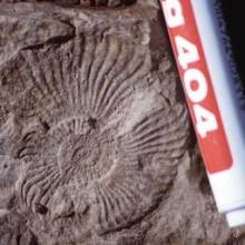
Ammonites, bivalves and plant fossils found in rocks of this mapping unit allow good age determinations and are shown in Table 1. Numerous outcrops south and southeast of the Co. Redondo (Loc. 26, 35, 36, 45, 67, 137, 138) show horizons rich in fossils, mainly ammonites and bivalves, but even plant fossils.
Ammonites are determined to belong to the genus Eoamaltheus spp. (transitional between Eoamaltheus and Fanniuoceras) (CH 26-8) and Fanniuoceras behrendseni (Samples CH9.1 and 9.2, CH55, Table 1a) and Fuciniceras sp. (Table 1b), respectively. They all indicate Pliensbachian, eventually Toarcian ages [Riccardi et al, 1992; Max Wippich, pers. comm.]. Apparent bivalves can be assigned to the genus Vola sp. (Table 1d) and genus Frenguelliella chubutensis (Feruglio) (Table 1c) [Riccardi et al., 1992]. The bivalves of the genus Vola sp. reach sizes up to 15x20cm. Ammonites and bivalves are concentrated in fine- to mid-grained sandstone and siltstone horizons in the middle of the lower unit. The genus’s of the plant fossils in the upper part of the lower subunit have not been determined (Table 1e) but they may indicate a filling-up of the grabens and increasing continental influence.
4.2.1.2 Microscopic description

 Siltstones of this unit show generally well preserved internal laminations and structures. Coarse to medium grain sizes varying between 30 and 60µm, in some cases below 20µm, and changing ratios between quartz grains and micaceous matrix define the lamination (compare Fig 15a). Elongated lens-shaped mudstone phacoids of lengths up to 1cm and parallel to the lamination can occur. Fractures are often coated with opaque minerals, most likely iron oxides. Monocrystalline quartz of 150-200µm size and probably magmatic origin are widespread. Sandstones can easily be distinguished from those of the Tepuel Group. As can be seen in Fig. 16b the fabric is matrix supported (approx. 15-25 Vol.%). Grain sizes ranging from 150-650µm, the mean grain size is 200-250µm, the rocks are poorly sorted. Particles are subangular to subrounded. 60-70% are quartz grains, around 5-10% lithic fragments, and up to 15% altered biotite, muscovite and chlorite as well as accessory opaque minerals. Elongated particles are preferable oriented parallel to the bedding. According to Tucker (1981), this lithology can be referred to as a quartz-wacke. Varieties include felspathic greywackes with feldspars of probably magmatic origin (Loc. 134, Fig 17) and lithic greywackes with mainly volcanic clasts (Loc. 132).
4.2.2 Volcanogenic Sequence
4.2.2.1 Field observations
 The upper part of the Liassic mapping unit is outstanding because of an accentuated morphology. It occupies the highest positions in the mapping area (e.g. Top and western slope of the Co. Redondo). Outcrops of this unit are characterised by a very rugged morphology. The transition between the two subunits shows no evidence for an unconformity. Rocks of the upper subunit are mostly fine-grained, with grey to greenish fresh colours and reddish to light-brownish weathering surfaces. Intercalations of white coloured rocks suggesting different composition caused most likely by changes in the eruptive cycles within the unit. Rocks generally show a porphyric texture with hypidiomorphic crystals of up to 3mm diameter in a very fine-grained matrix that prevents a mesoscopic description of the mineralogical composition. Slight changes in grain size are visible, indicating more or less the same attitude of bedding as in the underlying marine sediments. Lithic fragments and filled pores may also indicate a pyro- to epiclastic origin as well as hypidiomorphic phenocrysts of quartz and feldspars suggest an intermediate to acid (andesitic to rhyolitic) composition of the volcanic source.
4.2.2.2 Microscopic description
The analysed thin sections support the field-based interpretations. Hypiodiomorphic to idiomorphic crystals are embedded in a cryptocrystalline matrix. The composition, grain sizes, and the sorting vary within the analysed samples from three locations. Thin sections shown in Fig 18 & 19 (Loc. 21 and 79) show pyroclastic rocks with porphyric texture and devitrificated shards. Grain sizes range from 1.6mm down to 200µm indicating a poor sorting. Main phenocrysts are quartz grains (50%) with resorption features and plagioclases (40%) as well as lithic fragments (10%) of probably volcanic origin. Accessory minerals are mica (mainly biotite and chlorite) and opaque iron oxides. The ratio of matrix to phenocrysts is approximately 70:20. According to the definitions proposed by Schmincke (in Füchtbauer, 1988) this represents a matrix-rich crystal tuff. Broken quartz crystals as in Fig. 17 may indicate explosive eruptions [Fisher & Schmincke, 1984].

 Thin sections of white-coloured rocks in-between the crystal tuffs described above show well-sorted pyroclastic material with significantly smaller grain sizes of phenocrysts (between 100-500µm) and a streaked texture. They are mainly composed of hypidiomorphic quartz and plagioclase phenocrysts in a homogenous cryptocrystalline matrix. Elongated particles are oriented parallel to each other. Grain size, sorting and orientation of the particles suggest a more distal (ash) tuff deposit compared to those from Loc 21 and 79.
4.2.3 Contact Metamorphism

 The intrusion of the Tecka Formation in the unconformity between rocks of the Tepuel Group and Liassic rocks [Page, 1984] resulted in contact metamorphism of the overlying Liassic sedimentary and pyroclastic rocks and in increased hydrothermal activity. Significant hardening, splintering debris and the obliteration of (sedimentary) structures in the outcropping rocks reveal this overprint in mesoscopic scale. The contact aureole reaches up to 50m into the wall rocks of the intrusion. Rocks occurring at Loc. 51, 105, 110 and 119 show evidence for contact metamorphism and could be referred to as Hornfels. Thin sections show mostly fine-grained recrystallised rocks with a crypto- to microcrystalline quartz matrix (partly <10µm grain size). Coarser quartz grains are epitactically overgrown by fine-grained quartz (Fig 20). Rocks at Loc. 110 have spots composed of very fine-grained phyllosilicates that may be remnants of altered feldspar grains (CH112, Fig. 21). It is possible that this feature reflects contact metamorphism in the Liassic pyroclastic rocks. Apart from those microstructural features no characteristic mineral assemblages have been found.
4.3 Tecka Formation (Gabbro)
Olivine-tholeiitic and noritic gabbros of the Cresta de los Bosques in the southern Sierra Tepuel, about 70km south of the working area, have been subjects of studies by Page (1984). Turner (1982) has named intrusions in the Sierra de Tecka as Tecka Formation whereas Page (1984) uses the name Cresta de los Bosques Formation for all gabbros in the Sierras de Tecka and Tepuel. They intruded sediments of the Tepuel Group (Late Paleozoic) and Osta Arena (or Lepá) Formation (Liassic) as laccolithic bodies with variable dimensions and sills. Radiometric dating yielded Early Cretaceous ages of 120±10 Ma and 129 ±5 Ma [Turner, 1982; Turner in Page, 1984].
4.3.1 Field observations

 The Tecka Formation covers the eastern, northwestern and southern parts of the mapping area. The characteristic morphology is a smooth and hilly relief. Outcrops with exposed bedrock are rare and occur mostly as small flat lenses. In areas without exposed bedrock, this unit has been mapped using suboutcrops and boulders. Isolated outcrops of hydrothermally altered rocks and nearly pure quartz are found inbetween the gabbros. They are probably related to the latest stage of magmatic activity. A reddish homogenous boulder of nearly pure quartz with a diameter of 1.5m is exposed at Loc. 89, about 300m NE of the Pto. El Solitario (see Fig. 23). North of Loc. 41 gabbroic rocks are hydrothermally altered and internal structures are blurred by quartz.
 The igneous texture of the gabbro allows easy identification, in contrast to all other mapping units. Exposed surfaces show mostly a whitish weathered groundmass with reddish to brownish pyroxenes and a mostly homogeneous magmatic texture on the outcrop scale (Fig. 22a). Fresh pieces show a light-grey groundmass with dark hypidiomorphic crystals (Fig. 22b). Grain sizes range from fine-grained (<1mm) to coarse-grained in magmatic cumulates. Coarse-grained pegmatoid gabbros with up to 2cm long Hornblende crystals are found in the southeastern part (Loc. 147). Fine-grained rocks are exposed directly in contact to the overlying Liassic wall rock (Loc. 100 and Loc. 51), indicating a rapid cooling. They are preferably subject to weathering and strongly altered (Loc. 118 & 200m W’ of Loc. 51). At Loc.95, layered gabbroic rocks are exposed with alternating plagioclase and pyroxene layers of about 2cm thickness. Bronzite or Hypersthene can be identified due to their characteristic bronze and copper-red colours with the help of a hand lens. The groundmass is build up mainly of twinned plagioclase and a little amount of interstitial quartz grains.
4.3.2 Microscopic description
The predominant mineral in the analysed samples is plagioclase, making up around 70% by volume. The grains have a hypidiomorphic subhedral to anhedral shape. In the medium-grained samples, like in Fig. 24, the average size of plagioclase crystals is around 500µm * 150µm. Also glomerophyritic aggregates of up to 2mm in diameter occur. Subophitic to ophitic ortho- and clinopyroxenes with grain sizes of up to 3mm enclose plagioclase crystals and make up about 20% by volume. Sample CH59 (Fig. 24) shows clinopyroxenes, probably augite with lamellar intergrowths of orthopyroxenes. This microstructure may represent remnants of former pigeonite, a low-calcium monocline pyroxene that crystallised in early stage from the hot tholeiitbasaltic magma. During the slower cooling in the magma chamber the orthorhombic pigeonite crystals inverted and show lamellae augite [Deer et al., 1992; Matthes, 1993]. Interstitial quartz grains are a minor component and make up approximately 5-10%. Accessory minerals are biotite and opaque phases. Banded rocks show plagioclase crystals oriented subparallel to the layering suggesting a trachytic flow texture. In addition, the glomerophyritic plagioclase clusters are restricted to these layers. Due to the occurrence of bronzite and hypersthene, this rock can be described as a quartz-containing norite. [Matthes, 1993].
Especially the fine-grained gabbros show strong alteration with plagioclases replaced by sericite.


4.4 Tertiary Volcanogenic Rocks
Tertiary rocks unconformably overly the Gabbro of the Tecka Formation. The age of this unit is still uncertain. Crosscutting dykes within the Gabbro Cresta de los Bosques (Loc. 88) as well as pyroclastic rocks overlying the gabbro (Loc. 100) indicate a post-gabbroic age, respectively an erosional gap of uncertain time and subsequent deposition of this unit. Correlations with the stratigraphic column for the geological map 44c, Tecka [Turner, 1982] suggests Tertiary ages, (Eocene to probably Miocene) and affiliation to the so-called Complejo La Cautiva and / or the Carinao or La Mimosa Formations. Lithologies have been subdivided into dykes and pyro- to epiclastic rocks.
4.4.1 Dykes
4.4.1.1 Field observations
 The occurring dykes are found in-between the Gabbro or in the contact-zone between Gabbro and Liassic sediments. Fig. 26 shows four E-W aligned outcrops at Loc. 88 spreading over a distance of approximately 400m. Lithologies suggest that they belong to the same dyke system. Another three outcrops are localised north of the Co. Redondo, two between contact-metamorphic Liassic rocks and the gabbro at Loc. 129 and Loc. 51 as well as one isolated outcrop in the northwesternmost part of the mapping area (Loc. 126). Further are found in the northeastern part on the top of hills build up of gabbro.
 The grey-greenish and strongly altered rocks of this unit show a porphyritic texture often with cm-sized idiomorphic to hypidiomphorphic plagioclase crystals (Fig. 27). Smaller dark phenocrysts, later determined to be Hornblende, and some quartz are visible. Elongated pores and aligned crystals have been found in rocks of Loc. 88. Larger, mostly rounded cavities with up to 10cm in diameter may represent weathered xenoliths. The texture and mineral content suggests an intermediate, probably andesitic composition and a subvolcanic emplacement of these rocks.
4.4.1.2 Microscopic description
 In the polarisation microscope, all samples show a porphyric texture that indicates rapid final cooling of the magma (Figs. 28 & 29). Zoned Plagioclase crystals of up to 2mm grain size, sometimes with a glomerophyritic texture, are embedded in a crypto- to microcrystalline matrix composed of very fine-grained feldspars. Minor components are brownish idiomorphic to hypidiomorphic Hornblende crystals and volcanic lithoclasts of the same composition (Fig. 29). Some thin sections show strong alteration with iron oxides obscuring the original fabric. This may have been caused by hydrothermal activity later. Plagioclase crystals are altered and partially replaced by sericite (Fig. 28).

4.4.2 Epi- & Pyroclastic and Sedimentary Rocks
4.4.2.1 Field observations
 Tertiary sedimentary or pyroclastic rocks are restricted to the southeastern part of the mapping area. A sequence of this unit is exposed best 500m south of the Pto. El Solitario (Loc. 58 & 59). Soft rocks of light yellowish to white or light grey colour unconformably overly the gabbros of the Tecka Formation. They have a mudstone-like argillaceous character and show hypidiomorphic quartz and weathered feldspar crystals of up to 2mm grain size. A 1-5m thick bed of white rocks is intercalated in this sequence, reacting strongly with chloridic acid. It is also exposed at the Loc. 44 and 56 (Fig. 30). Here, round boulders composed mainly of pumice clasts are embedded in a fine-grained white carbonate matrix. According to Turner (1982), this lithology can be assigned to the Carinao Formation.
The upper parts of this mapping unit are made up of unconsolidated, matrix supported polymict conglomerates of intermediate (andesitic to rhyolitic) plutonic and volcanic rocks and pebbles of gabbro. Angular to sub-rounded components suggest short transport distances and are embedded in a matrix derived from underlying tuffs or tuffites. Chert pebbles occur as a thin layer in the top of the pumice bed and are also found as components of the conglomerates in the top of the unit. At Loc. 100, a tuff breccia is exposed. In a fine-grained matrix, lithoclasts of up to 5cm size are embedded. The overall thickness of this unit is approximately 20-30m. The unconformity implies an exposure of the underlying gabbroic rocks at the time of deposition.
4.4.2.2 Microscopic description
 Samples analysed by polarisation microscopy suggest a magmatic source of these rocks. The groundmass is build up of phyllosilicates. Although minerals of the cryptocrystalline groundmass could not be identified, altered phenocrysts of myrmekitic intergrowths of plagioclase and quartz (compare Fig. 31b) as well as zoned plagioclases may indicate a magmatic origin. Approximately 10% pheno-crysts and 90% matrix suggest a volcanic ash as source rock that was probably deposited as a tuffite [Füchtbauer, 1988]. Thin sections of the white rocks (Fig. 31a) show a matrix build up of micritic carbonate cement and embedded hypidiomorphic quartz and feldspar grains with sizes between 150 to 300µm. The amount of open pores is approximately 20%. All pores have a small rim of carbonate crystals with sizes of up to 20µm. Clasts of pumice are strongly altered and obscured by the carbonate cement.
4.5 Alluvial Cover
Unconsolidated alluvial sediments and soils are found in valleys, canyons, and cover also the lower slopes of the hills in the mapping area. They consist mainly of mechanically weathered pebbles of underlying bedrock with strongly varying grain-sizes, embedded in a sandy to silty matrix. As can be seen in Fig. 32 components are poorly sorted and have commonly an angular shape. They have sizes up to 10cm. Pedogenesis takes place in wind-protected areas, like valleys and in the wind shade of hills, where fine-grained aeolian sediments are deposited, as well as in areas with wet grounds and springs, where vegetation prevents a blowout of the pedal horizons. Erosional gullies are found south of the Co. Redondo, probably related to excessive water run-off during heavy rainfalls and snowmelt in the winter. The alluvial deposits have a thickness of at least 2m.
 Salty soils related to the Laguna Quichaura occur in the flats of the southeastern part in combination with thin evaporite-horizons.
Chapter 5 - Tectonics and Structures
Rocks in the mapping area have been affected by different tectonic events. However, the exposed rocks can be subdivided into two units. Sediments of the Late Paleozoic Tepuel Group have been folded and are slightly metamorphosed whereas the post- Paleozoic rocks show evidence of brittle faulting only. In addition to the geological fieldwork, photolineament-analyses have been carried out on aerial views and the magnified LANDSAT satellite image.
5.1 Tepuel Group

 Rocks of the Tepuel Group show strong evidence for deformation. At Loc. 29 (Fig. 33) and Loc. L175 (Lutz Limburg, Area3, Fig. 34) tight, to isoclinal folds are found. Both outcrops are about 10-15m in diameter with poor exposure conditions. Rocks are weathered and overgrown by scrubs and grass, complicating the identification of bedding structures and lithologies. The fold at Loc. 29 is composed of a succession of siliciclastic sediments with decreasing particle-size from conglomeratic sandstones at the outer part of the limbs to siltstones in the core of the fold. The folds are isoclinal and slightly overturned to the NNW, the limbs dipping with approximately 75-80˚ to the SSE. Folded strata of Loc. L175 dip with about 50˚-60˚ to the SSE and 30˚-45˚ to the NNW. Fold axis’ of both structures strike approximately 045˚- 055˚E. Medium- to fine grained sandstones outcropping at Loc. 156 show similar smooth and rounded internal structures as described by Claudius Vandré from Area no. 1. Microscopic analyses of rocks of this unit are described in Chapter 4-1 and show no evidence for temperatures significantly above 350˚C and pronounced internal deformation. Claudius Vandré proofed some deformation on the microscopic scale in samples of this unit in an outcrop 2-3km further south in mapping area no. 1. The Landsat image shows no special structural grain of Tepuel Group rocks in contrast to the other units. The most likely cause for that is the little amount of exposed Tepuel Group rocks. In the aerial view, these rocks have a slightly darker colour than the overlying lighter-coloured Liassic units. The change in colour in the aerial view is coincident with the unconformity. Márquez & Giacosa (1999) suggest Late Permian deformation ages.
5.2 Post-Paleozoic Rocks
 Brittle deformation and block faulting have also affected the rocks younger than the sediments of the Tepuel Group. However, there is no evidence for a strong deformation. Two processes are considered to have caused major imprints on the local geology. First the intrusion and emplacement of the gabbros of the Tecka Formation in Early Cretaceous times that was associated with a doming and uplift of the Liassic sediments due to the intrusion of the gabbroic laccolith. The second event was the Tertiary reactivation of extensional faults originally created during the Gondwana break-up.
The Tecka Formation was emplaced in an extensional regime [Page, 1984] largely above the brittle-ductile transition [Roman-Berdiel et al. 1995]. The gabbroic magma intruded the unconformity between Late Paleozoic rocks of the Tepuel Group and Liassic rocks. Overlying strata were displaced, distorted and integrated into blocks that are separated by normal faults. Similar structures have been described from laccoliths in SE Utah, USA [Jackson, 1992].

Strike and dip data collected in the field suggest three major blocks (compare cross section II, Geological Map, and Fig. 35). In combination with lithological observations (very coarse grain sizes of the gabbro) a local centre of intrusion east of the Co. Redondo is inferred. The central block is represented by the Co. Redondo, and shows uniform dip-direction values around 240˚-250˚ (WSW) with dip values between 15 and 20˚. Beds of the northern block have a general trend of dipping to the NW, with the same angle as around the Co. Redondo. Data collected in southern parts of the mapping area (e.g. Loc. 60 & 45) and by Claudius Vandré in the area south of the RP62 (see Geological Map of Claudius Vandré) show a southeasterly dip direction with angles between 15˚-25˚ (compare Fig. 35). Field observations and analysis of Landsat and aerial view images have identified a set of normal faults crosscutting the Co. Redondo and its southern parts, trending obliquely NE - SW. The comparison of outcrops in the southeastern part of the mapping area with those at the southern slopes of the Co. Redondo suggest a staircase-like geometry, with downward displacements of approximately 100m distributed over 3 or 4 faults. The difference in elevation between the isolated ammonite-bearing outcrops at Loc. 45 and corresponding beds at the southern part of the Co. Redondo is about 100m. About the same displacement is observed between Loc. 37 (1060m asl.) and the corresponding lithology at the southern peak of the Co. Redondo (1185m asl.). Another major normal fault is crosscutting the main block at the Co. Redondo obliquely from ENE to WSW. Comparison of the position of fossiliferous beds suggests a downward movement of the southern block by about 70-80m. Two normal faults have been found in the NE part of the mapping area, which may also be associated with the laccolith formation. At the western slope of the Co. Redondo the structural grain is more complex and was not resolved.
Compression probably also associated with the intrusion of the gabbro-laccolith. Fig. 36 (Loc.144) shows thrusted contact-metamorphic siltstones on a smaller scale. The displacement is approximately 2 to 3m. A thin layer of brecciated rocks marks the fault plane, which is dipping with 35˚ to the W.
5.3 Photolineaments in the Landsat Image
 The large surface area covered by the magnified LANDSAT image (Fig. 37) allows an overall view of the structural grain of the transition between the Sierras de Tecka and Tepuel. The most outstanding feature characterising this area is the smooth surface north and northwest of the Laguna Quichaura, which is probably caused by the gabbroic rocks. The Co. Redondo marks the abrupt southern end of the Sierra de Tecka, whereas the peaks slightly north of 43˚35’S indicate the northern end of the Sierra Tepuel.
In the working area, the Landsat picture shows several photolineaments that can be assigned to first and second order elements. NNW-SSE trending elements parallel to the sharp boundary between the Sierra de Tecka / northern Sierra Tepuel and the Río Tecka Valley in the west belong to the first order lineaments. Márquez & Giacosa (1999) found field evidence for a compressional fault, where post-tertiary rocks have been thrusted on tertiary rocks of the Río Tecka valley. They interpreted this structure as an extensional fault, initiated during the Gondwana break up, which was reactivated during the Andean compressional cycle. Two first order lineations are found west of the Laguna Quichaura running NW/NNW into area 3 (Lutz Limburg). They are probably associated with the main thrust faults of the Tecka valley. The most important first order lineament in the mapping area is a curved approximately N-S striking element at the southeastern border. Here, Tertiary sediments are limited to the west by an escarpment. No field evidence for a (thrust-) fault has been found. A second, less obvious lineation is limiting the slope of the Co. Redondo to the west and the hills north of the base-camp to the east. Despite some brecciated rocks at Loc. 48, no further evidence for either a thrust fault or compressional tectonics have been found in the field. A set of 5 NE-SW striking second order elements (compare geological map) is found in the mapping area crosscutting the Co. Redondo massif. They are interpreted to belong to a fault generation related to laccolith-tectonics caused by the intrusion of the gabbro and probably initiated in Early Cretaceous times.
Chapter 6 – Conclusions: Summary of the Geological History
Paleozoic sedimentary rocks occurring in the area have been probably deposited in a fore-arc to intra-arc setting. Mature arenites, conglomerates as well as siltstones indicate a changing depositional environment. Folded strata of this unit suggest a low grade metamorphism with temperatures significantly below 350˚C as well as deformation during Late Paleozoic / Early Mesozoic times that may have been related to subduction at the western margin of ancient Gondwanaland. The obliteration of internal structures within the fine-grained sediments is also indicative for slight deformation or bioturbation early after deposition.
Liassic sediment deposition took part in elongated extensional basins or half graben structures that were initiated during the Gondwana break-up extensional phase. Conglomeratic sandstone beds deposited on top of a basal unconformity are followed by a succession of marine mid- to fine-grained siliciclastic sediments with ammonites and bivalves, indicating a shallow marine environment. Most likely marine transgressions came from the N or NW, eventually from the Neuquén basin area [Riccardi et al., 1992]. Slump structures and a complex facies mosaic reflect an unstable and quickly changing depositional environment. The occurrence of plant fossils within the upper part of the sequence may indicate a change towards more continental influence and a littoral/fluvial environment. Intermediate to acid pyroclastic rocks of the Lepá Formation are the local expression of a successively increasing continental influence and high volcanic activity due to extension and Gondwana break-up.
The unconformity and rheological contrast between Palaeozoic rocks of the Tepuel Group and overlying Liassic sediments of the Lepá Formation have controlled emplacement of gabbro laccoliths and associated sills of the Tecka Formation. The overlying Liassic sediments have been displaced, tilted, and slightly compressed by the intrusion. Strata on the flanks, and especially the roof of the laccolith were subject to local extension and normal faulting. Displacements of about 100m have been found at the southern slopes of the Co. Redondo and in southern parts of the mapping area. Contact metamorphism and increased hydrothermal activity affected the wall rocks of the laccolith within a distance of up to 50m from the intrusion. Strike and dip data collected in the field show an anticlinal structure with a westerly-dipping axis, suggesting one centre of the laccolithic intrusion to be situated in the eastern prolongation of the Co. Redondo. This is supported by the occurrence of coarse-grained gabbro and magmatic cumulates in the eastern part of the mapping area.
Volcanic and sedimentary rocks of post-gabbro age (most likely Tertiary) have been deposited in continental environment. They rest unconformably on gabbroic rocks of the Tecka Formation, which implies an erosional gap of uncertain time. Pyroclastic deposits and dykes exposed in the mapping area are probably related to the magmatic activity of the Complejo La Cautiva or the Tertiary Co. Negro de Tecka volcano. Conglomerates of mainly volcanic source rocks are consistent with the continental environment.
Extensional faults of the Gondwana break-up stage may have been reactivated during the Andean compressional stage in the Late Tertiary. Evidence for this is found north and south of the working area where tertiary sediments are uplifted in tectonically elevated positions and thrusted onto pre-Tertiary rocks [Márquez & Giacosa, 1999]. There is no direct evidence for this in the mapping area, although block faulting has occurred there as well.
Alluvial regolith was deposited due to weathering of the bedrock. Soils develop in valleys and wind-protected areas.
Enclosures
- Geological Map 1:23,000 of the southern Sierra de Tecka, north of the Laguna Quichaura, Chubut Province, Argentina.
- Table 1: Fossils of the Lepá Formation
- Table 2: List of analysed samples and thin sections
Acknowledgments
First, I would like to thank gratefully Prof. Dr. Stöckhert and the Institute of Geology in Bochum for the support and help, his Patagonia-connections and the financial aids. Muchas Gracias to Prof. Marcelo Márquez and his family for help, hospitality, his attendance and the introduction in the geology of one of the greatest landscapes on earth.
My very special thanks go to Claudius Vandré for all the ‘fruitful’ discussions and to Lutz Limburg. I’ll always remember the great time we had in Patagonia and the e-mail support for my Sydney-TGIF-seminar.
Juan Carlos Afonso was one of the craziest guys I met down there and he’d become a good friend. A very big “thank you” for the tremendous help in Comodoro and the nice days at Mr. Rio’s.
Adriana Nillni and Cristian Palaviccino is thanked for their unbelievable hospitality and their help in Comodoro (and the cold Quilmes that has always been around).
Biggest supporters of this work have been my parents. Thanks a lot for all the help, they made my dream come true.
Thanks go also to Maria Del Carmen Martinez for the translations and proof-reading; to Craig O’Neill for proof reading my “Aussie” English; to Max Wippich for the help to determine the fossils; to the office mates: Thomas, Markus, Heiko, Lutz and Timo for the support and critical discussions, and to all people of the “Internado” in Tecka for hospitality, help and their patience with the “tres alemanes”
Thank you, Nina, for the 15months of patience.
References
[(Bruhn.EPSL.1978» title : Field and and geochemical data bearing on the development of a Mesozoic volcano-tectonic rift zone and backarc basin in southernmost South America authors : Bruhn, R.L. Stern, C.R., and DeWitt, M.J. journal : Earth Planet. Sci. Lett. published : 1978 pages : 32-46 )]
Bruhn, R.L. Stern, C.R., and DeWitt, M.J. (1978): Field and and geochemical data bearing on the development of a Mesozoic volcano-tectonic rift zone and backarc basin in southernmost South America. Earth Planet. Sci. Lett. 41, 32-46.
Cingolani, C., Dalla Salda, L., Hervé, F., Munizaga, F., Pankhurst, R.J., Parada, M.A., and Rapela, C.W. (1991): The magmatic evolution of northern Patagonia; New impressions of pre-Andean and Andean tectonics, in: Harmon, R.S. and Rapela, C.W. (eds.): Andean Magmatism and Its Tectonic Setting. Geol. Soc. Amer. Spec. Paper 265: 29-44.
Collins, J.D. & Thompson, D.B. (1982): Sedimentary Structures. Allen & Unwin, London, 194pp.
Dalziel, I.W.D. (1981): Back-arc extension in the Southern Andes: A review and critical reappraisal. Philos. Trans. R. Soc. London., Ser. A, 300, 319-335.
Deer, W.A., Howie, R.A., Zussman, J. (1992): An introduction to the Rock-Forming Minerals. 2nd edition, Longman, pp.166-169.
Fisher, R.V. & Schmincke, H.-U. (1984): Pyroclastic rocks.` Springer-Verlag, Berlin. pp 89-124
Forsythe, R. (1982): The late Palaeozoic to early Mesozoic evolution of southern South America: a plate tectonic interpretation. J. Geol. Soc. London, Vol. 139: 671-682.
Franchi, M., Panza, J., and De Barrio, R. (1989): Dépositos Triasicas y Liasicas de la Patagonia Extraandina, in: Chebli, G., Spalletti, L. (ed.) Cuencas Sedimentarias Argentina, pp 359-367.
Füchtbauer, H. (1988): Sediment-Petrologie Teil II: Sedimente und Sedimentgesteine. Schweizerbartsche Verlagsbuchhandlung, Stuttgart.
Gust, D.A., Biddle, K.T., Phelps, D.W., and Uliana, M.A. (1985): Associated Middle to Late Jurassic volcanism and extension in southern South America. Tectonophysics 166: 223-253.
Haller, M.J. and Lapido, O.R. (1982): El Mesozoico de la Cordillera Patagonica Central. Rev. Asoc. Geol Argent., 35(2), 230-247.
Hanson, R.E. & Wilson, T.J. (1991): Submarine Rhyolithic Volcanism in a Jurassic Proto-Marginal Basin; Southern Andes, Chile and Argentina, in: Harmon, R.S. and Rapela, C.W. (eds.): Andean Magmatism and Its Tectonic Setting. Geol. Soc. Amer. Spec. Paper 265: 13-28.
**http:%%%%www.britannica.com/bcom/eb/article/7/0,5716,117567+4+109564,00.html**
Jackson, M. (1998): Processes of Laccolithic Emplacement in the Southern Henry mountains, Southeastern Utah, in: Friedman, J.D. & Huffman, A.C. (eds.): Laccolithic Complexes of Southeastern Utah: Time of Emplacement and Tectonic Setting – Workshop Proceedings. US Geol. Surv. Bull. 2158, Washington, pp 51-59.
Lawver, L.A., Gahagan, L.M., and Dalziel, I.W.D (1999): A Tight fit-Early Mesozoic Gondwana, a Plate Reconstruction Perspective, in Motoyoshi, Y. and Shiraishi, K. (editors), Origin and Evolution of Continents: Proceedings of the International Symposium “Origin and Evolution of Continents”, 13-14 October, 1997, Tokyo, Memoirs of National Institute of Polar Research, Special Issue, No. 53, p354. 214-229.
Lesta, P., Ferello, R., Chebli, G. (1976): Chubut Extraandino, in: Segundo Simposio de Geologia Regional Argentina , Vol. II: 1307-1387. Academia Nacional de Ciencias, Cordoba
Malumián, N., Ramos, V.A. (1984): Magmatic intervals, transgression-regression cycles and oceanic events in the Cretaceous and Tertiary of southern South America. Ea. Planetary Sci. Letters, 67:228-237
Márquez, M.J., Giacosa, R.E. (1999): Deformaciones dúctiles paleozoicas y corrimientos terciarios an el Neopaleozoico del Chubut. Consecuencias estratigráficas y tectónicas. In press
Martínez, M. d. Carmen (2000): Téctonica, metarmorfismo y magmatismo del basamento ígneo metamórfico localizado en el nordest del Macizo del Deseado, Stanta Cruz, Argentina. Unpubl. PhD Thesis, Ruhr-Univ. Bochum, pp. 193-196.
Matthes, S. (1993): Mineralogie. Eine Einführung in die spezielle Mineralogie, Petrologie und Lagerstättenkunde. Springer-Verlag Berlin, pp. 131-136, 189, 198-199, 240-243.
Nürnberg, D. and Müller, R.D. (1991): The tectonic evolution of the South Atlantic from late Jurassic to present. Tectonophysics, 191, 27-53.
Page, R.F.N., Limario, C.O., López Gamundi, O., and Page, S. (1984): Estratigrafia del Grupo Tepuel en su Perfil Tipo y en la Region El Molle, Provincia del Chubut. Noveno congreso Geológico argentino, San Carlos de Bariloche, Actas II: 619-632.
Page, S. (1984): Los gabbros bandeados de la Sierra de Tepuel. Cuerpos del Sector Suroeste, Provincia del Chubut. Noveno Congreso Geológico Argentino, San Carlos de Bariloche, Actas II: 584-599.
Pankhurst, R.J., Rapaela, C.R. (1995): Production of Jurassic rhyolite by anatexis of the lower crust of Patagonia. Earth Planet. Sci. Let. 134: 23-36.
Passchier, C.W., Trouw, R.A.J. (1998): Microtectonics. Springer, Berlin, pp. 26-28, 48.
Pettijohn, F.J. (1975): Sedimentary Rocks (3rd Edition). Harper & Row, New York, 628pp.
Pettijohn, F.J., Potter, P.E., Siever, R. (1972): Sand and Sandstones. Springer, Heidelberg.
Ramos, V.A. & Kay, S.M. (1992): Southern Patagonian plateau basalts and deformations: backarc testimony of ridge collisions. Tectonophysics, 205: 261-282.
Ramos, V.A. (1983): Evolucion Tectonica y Metalogenesis de la cordillera Patagonica. II° Congreso Nac. Geología Ecónomica Actas I: 108-124.
Ramos, V.A. (1988): Late Proterozoic-Early Palaeozoic of South America – a Collisional History. Episodes Vol.11, No.3: 168-174.
Rapalini, A.E., Tarling, D.H., Turner, P., Flint, S., and Vilas, J.F. (1994): Palaeomagnetism of the Carboniferous Tepuel Group, central Patagonia, Argentina. Tectonics, Vol.13, No.5: 1277-1294.
Rapela, C.W. & Pankhurst, R.J. (1992): The granites of northern Patagonia and the Gastre Fault System in relation to the break–up of Gondwana, in: Storey, B.C., Alabaster, T., Pankhurst, R.J. (eds.) Magmatism and the Causes of Continental Break-up. Geol. Soc. Spec. Publ. No. 68:209-220.
Rapela, C.W., Kay, S.M. (1988): Late Palaeozoic to Recent Magmatic evolution of Northern Patagonia. Episodes Vol.11, No. 3: 175-182.
Riccardi, A.C., Guilsano, C.A., Mojica, J., Palacios, O., Schubert, C., and Thomson, M.R.A. (1992): Western South America and Antarctica. in: Westermann, G.E.G (ed.): The Jurassic of the Circum-Pacific, World and Regional Geology 3. Cambridge Univ. Press, pp. 183-195, 635-640.
Roman-Berdiel, T., Gapais, D., and Brun, J.P. (1995): Analogue models of laccolith formation. - J. Struct. Geol. 17: 1337-1346; Oxford.
Saunders, A.D. Tarney, J., Stern, C.R., and Dalziel, I.W.D. (1979): Geochemistry of Mesozoic marginal basin floor igneous rocks from southern Chile. Geol. Soc. Am. Bull., 190, 237-258.
Storey, B.C., Alabaster, T. Hole, M.J., Pankhurst, R.J., Wever, H.E. (1992): Role of subduction-plate boundary forces during the initial stages of the Gondwana break-up: evidence from the Proto-Pacific margin of Antarctica, in: Storey, B.C., Alabaster, T., Pankhurst, R.J. (eds.) Magmatism and the Causes of Continental Break-up. Geol. Soc. Spec. Publ. No. 68:149-163.
Suero, T. (1962): Paleogeografía del Paleozoico superior de la Patagonia (Republica Argentina). Rev. Asoc. Geol. Argent., 16(1-2), 35-42.
Tucker, M.E. (1981): Sedimentary petrology – An introduction. Blackwell Scientific Publ., Oxford, pp. 10-66, 230-239.
Turner, J.C.M. (1982): Descripción Geológica de la Hoja 44c, Tecka, Provincia de Chubut. Serv. Geol. Nac., Boletín No. 180, Buenos Aires.
Turner, J.C.M. (1982): Hoja 44c: Tecka, Provincia de Chubut. Carta Geológico-Económica de la República Argentina. Serv. Geol. Nac., Buenos Aires.
Uliana, M.A., Biddle, K.T. (1987): Permian to Late Cenozoic Evolution of Northern Patagonia: Main Tectonic Events, Magmatic Activity, and Depositional Trends in: McKenzie, G.D. (ed.) Gondwana Six: Structure, Tectonics, and Geophysics. Amer. Geophysical Union Monograph 40:271-286.
Vandré, C. (2000): Geological map of the northern Sierra de Tepuel near Laguna Quichaura (Departemento Languiñeo, Chubut Province). Unpubl. mapping report, Ruhr-Universität Bochum.
White, R.S. (1992): Magmatism during and after continental break-up, in: Storey, B.C., Alabaster, T., Pankhurst, R.J. (eds.) Magmatism and the Causes of Continental Break-up. Geol. Soc. Spec. Publ.; No. 68:1-16.
Zeil, W. (1986): Südamerika (Geologie der Erde, Band 1). Enke, Stuttgart
Table 1: Fossils of the Osta Arena / Lepá Formation


Table 2: List of samples (thin sections)
| Locality | No. of sample | Orientation data | Rock | |
| 44 | - | CH 13 | outcrop | Altered pumice |
| 58 | - | CH 22 | boulder | Andesite |
| 59 | - | CH 36.1 | outcrop | Tuffite |
| 74 | - | CH 41 | 331/82 (joint) | Grupo Tepuel quartzarenite |
| 76 | - | CH 44 | 152/57 (joint) | Pyroclastic rock |
| 77 | - | CH 47 | 200/05 (bedding) | Quartz-wacke |
| 79 | - | CH 48 | 222/61 (bedding) | Pyroclastic rock |
| 89 | - | CH 59 | outcrop | Gabbro, inverted pigeonites |
| 94 | - | CH 62 | outcrop | Andesite |
| 96 | - | CH 65 | boulder | Gabbro |
| 98 | - | CH 67 | outcrop | Vulkanit |
| 100 | - | CH 73 | boulder | Tuff-breccia |
| 102 | - | CH 76 | outcrop | Andesite (Dyke) |
| 88 | - | CH 77 | outcrop | Andesite (Dyke) |
| 104 | - | CH 81.1 | outcrop | Hornfels |
| 106 | - | CH 83.2 | 134/41 (joint) | Hornfels |
| 119 | - | CH 96 | outcrop | Hornfels |
| 60 | - | CH 100 | outcrop | Gabbro |
| 123 | - | CH 106 | outcrop | Hornfels |
| 123 | - | CH 108 | boulder | Contact-metamorphic pyroclastic rock |
| 110 | - | CH 112 | outcrop | Contact-metamorphic pyroclastic rock |
| 51 | - | CH 117 | outcrop | Hornfels, adjacent to gabbro-contact |
| 132 | - | CH 122 | boulder | Breccia |
| 134 | - | CH 124 | outcrop | Greywacke |
| 135 | - | CH 126 | 086/35 (bedding) | Contact-metamorphic siltstone |
| 95 | - | CH 131 | outcrop | Siltstone |
| 65 | - | CH 135 | outcrop | Lithic arenite |
| 71 | - | CH 136 | outcrop | Mid-grained sandstone |
| 144 | - | CH 140 | outcrop | Laminated siltstone |
| 150 | - | CH 146 | 282/70 (joint) | Breccia |
| 155 | - | CH 157 | 325/30 (bedding) | Grupo Tepuel siltstone |
| 21 | - | CH 166 | outcrop | Pyroclastic rock |
| 28 | - | CH 167 | outcrop | Grupo Tepuel quartzarenite |